

More Maps = More Adventures
A huge selection of maps for exploring the wilderness are at your fingertips with BackCountry Navigator. We make it easy for you to download and use topo maps, marine charts, aerial photography and more. Not only that, backers will be first in line to suggest map services from governments or organizations willing to work with us.
Overlays Aplenty
We’re enabling the use of more overlay options than ever before, both free and affordable. These will include BLM Boundary maps, property maps, lake map contours, trail maps, specialty data and more. Whatever your adventure, we've got you covered.

Recreation Overlay
Easier Grid-Based Organization
Saving map areas offline will be simple, with an easier, grid-based approach. Get it downloaded and keep it organized.

Storage of offline maps
Going Global with VECTOR TOPO MAPS
Download vector topo maps for the Earth's surface with easy installation. Compact storage will allow whole states and countries to be downloaded. Flexible styles will make them most readable for you.

Vector Topo Maps - large areas, flex style
Easy To Learn
One of the major pieces of feedback we've had over the years is that the existing app can be a bit difficult to get the hang of. For BackCountry Navigator XE, we'll be focusing on making the app easy to learn and simple to use, so you can get exploring the outdoors quicker than ever!
Planning In The Cloud
With the cloud editor, you'll be able to plan your treks, and upload tracks and waypoints to customize your adventure on the web before you go. Your plans will synchronize effortlessly with your mobile device so you can navigate the outdoors easily. When you get back home, you'll be able to review exactly where you explored.
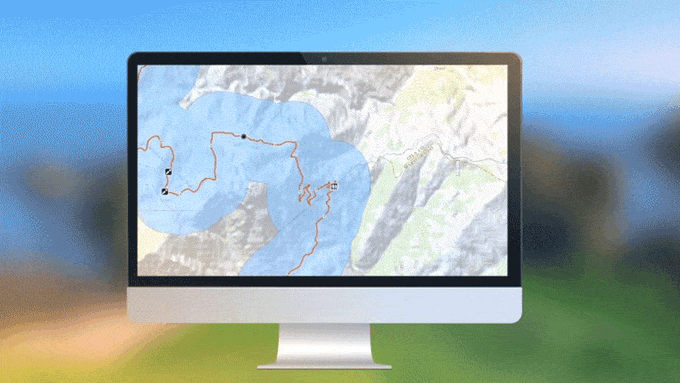
Cloud Editor with Easy Sync
No Signal? No Worries
Today, your smartphone isn't limited to cell towers; it has the same hardware that’s been used by the military and handheld GPS devices for decades. Download the maps you need before you head out into the backcountry and your phone's GPS will handle the location tracking. BackCountry Navigator will work even when there isn’t any cell coverage.